BEIJING, May 3 (Xinhua) -- The Philippines has long pinned its hopes on the international community to woo sympathy for its groundless claim for some of China's islands in the South China Sea.

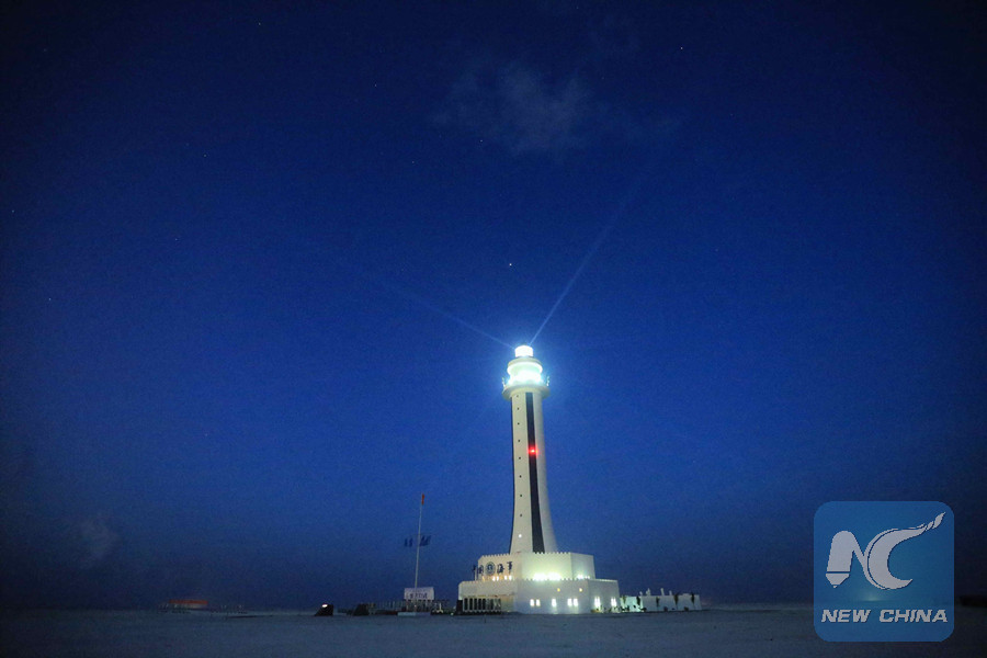
Photo taken on April 5, 2016 shows the lighthouse on Zhubi Reef of Nansha Islands in the South China Sea, south China. (Xinhua file photo)
However, facts speak louder than words. The following are ironclad facts about Manila's notorious acts of illegal encroachment upon China's Nansha Islands.
Historically, the Philippine territory was defined and demarcated by a series of treaties, including the Treaty of Peace of Paris 1898 between the United States and Spain, the U.S.-Spanish Treaty of Washington of 1900, and the 1930 Convention regarding the Boundary between the Philippine Archipelago and the State of North Borneo between the United States and Britain.
All the above-mentioned treaties clearly indicate that the west boundary of the Philippine territory was 118 degrees east longitude. This borderline was recognized and reaffirmed by the 1935 Constitution of the Republic of the Philippines.
The Nansha Islands were not included nor recorded in any of the aforesaid treaties. But the Philippines began to covet those islands in the 1930s.
On Aug. 12, 1933, in a letter to the then U.S. governor of the Philippines, a former senator of the U.S.-ruled Philippine Islands attempted to claim that part of the Nansha Islands belonged to the Philippine territory on account of "geographical proximity."
However, the U.S. side rejected the Philippines' claims in August 1935, pointing out that there exists a geographical and natural separation between the Nansha Islands and the Palawan Island along with its affiliated islands.
The Nansha Islands are separated from the Philippine territory by the 1,300-2,600 meter deep Palawan Trench along the Palawan Passage.
Furthermore, before the United States took over the Philippines, Spain had never exercised sovereignty over, or made claims of sovereignty for, any of the Nansha Islands.
Nevertheless, the lack of the U.S. support did not discourage the Philippines from making further illegal attempts to encroach on the Chinese territories.
On July 23, 1946, Elpidio Quirino, then vice president and foreign minister of the Philippines, declared that "Shinnan Gunto" (the Nansha Islands) should be part of the Philippine territory as these islands were critical to its national security.
On May 17, 1950, Quirino, who was then Philippine president, restated that the Nansha Islands should belong to the nearest country, that is, the Philippines.
On March 1956, Tomas Cloma, owner of the Philippine Maritime Institute, led an expedition to the Nansha Islands. He claimed that these islands were "terra nullius," and even named them "Kalayaan."
Faced with a solemn representation from China, the Philippine side said that Cloma's personal action had nothing to do with the Philippine government and that it had no territorial claims for those islands.
Despite that, the Philippines has in fact never given up its attempts to challenge China's sovereignty over the Nansha Islands.
Since the 1970s, the Philippines has illegally occupied a number of maritime territories of China's Nansha Islands, including the Mahuan Dao, the Feixin Dao, the Nanyao Dao, the Zhongye Dao, the Xiyue Dao, the Beizi Dao, the Shuanghuang Shazhou and the Siling Jiao.
In order to continue expanding its territory and legalize its illegal actions, the Philippines has even made a series of preposterous claims such as "terra nullius," "geographical proximity" and "trust territory."
To sum up, what the Philippines has done runs totally contrary to historical facts, reality and international law.
Any attempt by the Philippines to negate China's sovereignty, rights and interests over the Nansha Islands will prove to be nothing but its own wishful thinking, and will end in failure.


