Source:
04-22-2009 17:20
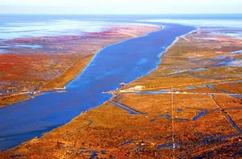
The Yellow River is an important water source for the northwestern and northern areas. It is the second longest river in China. It rises on the Yueguzonglie Basin of the northern slopes of the Bayankela Mountain of the Qinghai Plateau and flows east through the Loess Plateau and Huang-Huai-Hai Plain and empties into the Bohai Sea. The total length of the mainstream is 5,464 km with a river fall of 4,480m and a draining area of 795,000 km2. Its annual natural runoff is 58 billion m3.
 |
| The Yellow River is an important water source for the north- western and northern areas. |
The mainstream of the Yellow River traverses North China from the west to the east covering nine provinces and autonomous regions: Qinghai, Sichuan, Gansu, Ningxia, Inner Mongolia, Shaanxi, Shanxi, Henan and Shandong. The nationalities living within the river basin include the Han, Hui, Zang and Mongol, with a total population of 107,000,000, accounting for 8.6% of the national population.
The GDP of the Yellow River basin is 484 billion Yuan; the gross industrial output value is 601.5 billion Yuan, accounting for 5.3% of the national value; the gross agricultural output value is 150.9 billion Yuan, accounting for 6.1% of the national value (data of 1997).
2. Physical Geography
The Yellow River basin connects with the Bayankela Mountain on its west, the Yinshan Mountain on its north and the Qinling Mountain on its south, and runs east to the Bohai Sea. The contour of the basin goes from being high in the west to low in the east with a height difference that forms a three-level ladder from the west to the east and from the high to the low. This comprises the Qinghai Plateau - the riverhead; the Loess Plateau, and the low North China Plain - the plains.
Because the mainstream of the Yellow River has many bends, the actual flow of the river is 2.6 times that of a straight-line distance from river head to the estuary. The river course can be divided into the upper, middle, and lower reaches with 11 river stretches.
2.1 The upper reach
The upper reach is from the river head to Hekou Town of Tuoketuo County of the Inner Mongolia Autonomous Region, with a total length of water course of 3471.6 km and a catchment area of 428,000 km2 accounting for 53.8% of the catchment area of the river.
The basin above Duoshixia of Maduo County in the upper reach of the Yellow River is called the riverhead area. The total length of the water course from Maduo to the lower rivers is 2211.4 km with a river fall of 2,985m being the resource area of water power of the Yellow River. The total length of the water course from the lower river to Hekou Town is 990km with a catchment area of 174,000 km2 and a river fall of 246m.
2.2 The middle reach
The middle reach of the Yellow River goes from Hekou Town to Taohuayu of Zhengzhou City of Henan Province. The total length of the middle reach is 1206.4 km with a catchment area of 344,000 km2 accounting for 43.3% of the total catchment area, and with a river fall of 890m.
The Yellow River from Hekou Town to Yumenkou is the canyon stretch of the Jinxia Canyon with a total length of 725 km and a river fall of 607m. The vast Loess Plateau is on both banks of the canyon with loosen earth, which leads to severe water and soil erosion; the Hukou Fall on the downstream of the canyon is the only fall in the mainstream of the Yellow River. The total length of river course of stretch from Yumenkou to Tongguan is 125km with a river fall of 52m and frequent course changes of the river. The total length of the stretch from Tongguan to Taohuayu of Zhengzhou City is 356km with a river fall of 231m, including Loess Canyon and Jinyu Canyon, it is an important sources for water supply in the lower reaches of the Yellow River.
