60 years of Beijing: from ancient capital to livable city
2009-08-13 15:57 BJT Mail
Mail Share
Share Print
Print
Beijing is located on the northwestern tip of the North China Plain, with the Yanshan Mountain range to the north and the Taihang Mountain range to the west. To the southeast lies a plain which dips towards the Bohai Sea. The city is about 150 km from the coastline. Since the 10th Century, the Liao, Jin, Yuan, Ming and Qing dynasties have successively made this city the alternate capital or national capital.
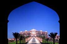
The city of Beijing has experienced many changes, and the Old City left today was mostly built in the Ming Dynasty. In January, 1949, the peaceful liberation of the city ushered in a new era. The past six decades have witnessed notable achievements in urban planning. City roads, public transport, water supply, drainage, electricity, telecommunications and greenery have made great progress; gas and central heating have made an appearance in the city; a comprehensive modern industry has been established; and commerce, education, science, culture, health, sports, tourism and other undertakings have all gone through gratifying development. Beijing Urban Comprehensive Plan (2004-2020) sets a clear objective for Beijing: strive to be "a national capital, an international city, a cultural city, and a livable city."
Overall plan
The "2 axes-2 belts-multiple centers" layout
After the founding of the People’s Republic of China (PRC), the Old City became the city center of the capital, and retained its original layout. The original eight-kilometer north-south axis has extended to Nanyuan in the south, and the tendency for northward extension is becoming increasingly apparent. After several expansions and east-west extensions, the original 3.7-kilometer east-west Chang’an Avenue has developed into a new axis running from Tongzhou in the east to Shijingshan in the west. Tiananmen Square, the meeting point of the axes, after three reconstructions, expanded from 11 hectares to 40 hectares, and evolved from a closed imperial front yard into a magnificent and spacious city square.
Over the past six decades, Beijing, with the Old City at the center, has expanded in all directions, and six new areas close to the Old City have formed. These are the industry-oriented suburbs in the east, south and southeast; suburbs with a high concentration of government departments in the west and north; and suburbs with a high concentration of universities and research institutions the northwest. Vast stretches of vegetable fields, farmland and greenery lie as separation belts between these new areas and the Old City to form a “scattered cluster” urban layout. In outer suburban areas, taking industrial development and the construction of existing counties into consideration, importance should be attached to building satellite towns.
In January 2005, Beijing Urban Comprehensive Plan (2004-2020) was approved. Based on a comprehensive analysis of the past, present and future of Beijing, and with the demands of overall regional development taken into account, the Plan proposed a city-town structure of “central city -new city -town,” in order to disperse urban functions, advance urban-rural integration, promote regional coordination and accomplish intensive development, and to carry out the “2 axes -2 belts -multiple centers” layout. In the city-town structure, the new city is a concrete embodiment and an important node of the “2 axes -2 belts -multiple centers” layout. The Plan puts forward the goal of building 11 new cities, with Tongzhou, Shunyi and Yizhuang as three key new cities.


 Video
Video


On CCTV
Get the Channel, CCTV Live, CCTV Live in HD, CCTV-5 (Sports) Live, Latest Video, TV ScheduleCCTV-9 News Programs
Asia Today, Biz China, CCTV News, China This Week, China Today, Culture Express, Dialogue, News Hour, Sports Scene, World Insight, World Wide Watch
Newsletter
RSS
Site Map
|
Contact Us
|
About Us
|
FAQ
|
Jobs
|
Advertise
|
Privacy Policy
|
Terms of Use
 2009 China Central Television. All Rights Reserved