


“The First National Geographic Census Bulletin of Yunnan Province“ was published in Kunming on October, 20, 2017. With 16.422 million map delineations, this bulletin exactly revealed the geographical conditions of Yunnan. Advanced techniques such as space and aviation remote sensing, GPS and GIS were used to capture the pictures from 400 kilometers above the earth. Viewing from this height, we can discover the hidden beauty of our motherland.
A flying dragon-- Yunlong Reservoir
It is located at Luquan county, Kunming city. From remote sensing image, the spidery and winding reservoir is just like a dragon flying in the clouds.
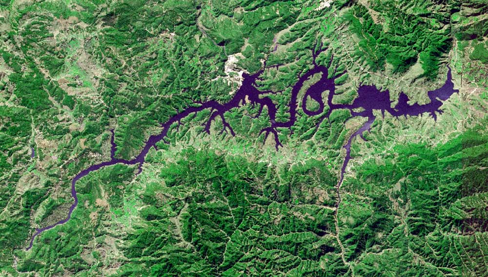
Yunlong Reservoir (Photo: Xinhua)
A leaf-- Zhonghe Town of Yongren County
From remote sensing image, we can see a special “leaf” on the earth of Yunnan province. Located at Zhonghe Town of Yongren County, Chuxiong Yi Autonomous Prefecture, it is a small basin in the valley, with a little hill on the top. The distribution of the hill’s ridge line is almost the same as a leaf in the nature.
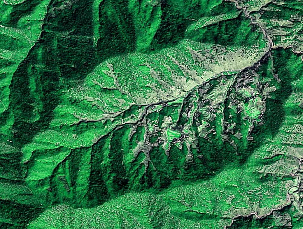
Zhonghe Town of Yongren County (Photo: Xinhua)
Nature’s Palette-- Dongchuan Red Land
Dongchuan, a rural area in the northeast of Kunming, SW China's Yunnan Province, is believed to have the world's most imposing red earth. The scenic spots are situated mainly at an altitude between 1,800 and 2,600 meters above the sea level. Due to the warm and humid climate, the Iron oxide in the soil deposits slowly through the years and gradually develops an extraordinary reddish brown soil. Throughout the year, the soil is covered alternately with highland barley flowers, buckwheat plants, green taro plants and rape flowers, and the bright-colored blocks spread to the sky. People call it “Nature’s Palette”.
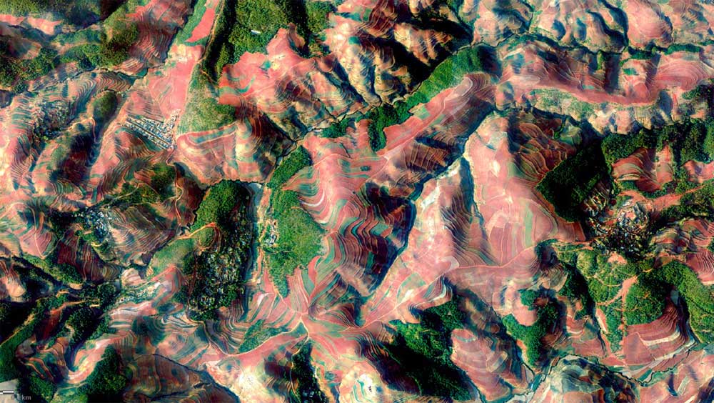
Dongchuan Red Land (Photo: Xinhua)
Abstract oil painting-- Xundian Hui and Yi Autonomous County
Located in the northeast Yunnan province, it is a vital communication hub. The county’s territory is high in the northwest and low in the southeast, looks like a stair-step. This colorful image shows the result of the sloping landform combined with roads across the mountains. Though messily strewn at random, it is still a splendid art work.
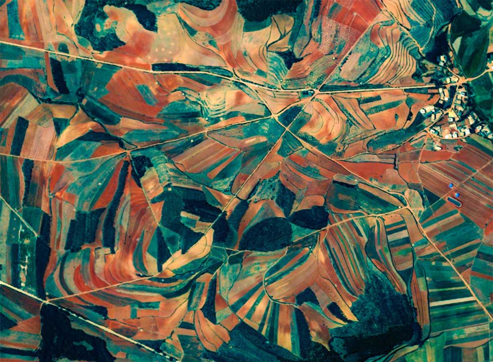
Xundian Hui and Yi Autonomous County (Photo: Xinhua)
A fish-- Manting Village in Xishuangbanna Dai Autonomous Prefecture
It is located in Menghan Town of Jinghong City, Xishuangbanna Dai Autonomous Prefecture, in the south is the Lancang River.The plain along both of the river side is covered with plantations. The river cut the plain into two parts, like two fish look at each other.
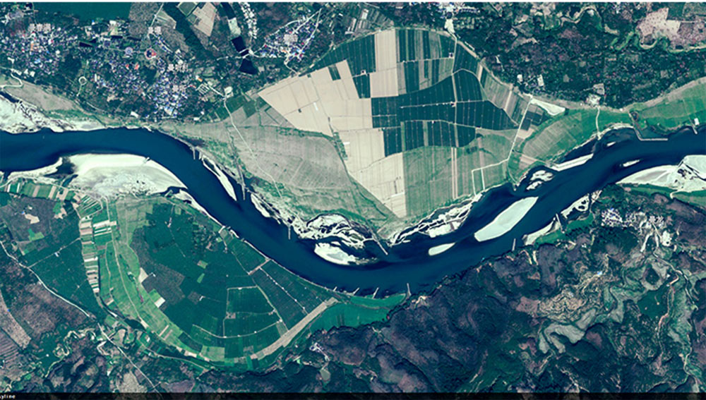
Manting Village in Xishuangbanna Dai Autonomous Prefecture (Photo: Xinhua)
A baby-- Sword Lake in Jianchuan County
The Sword Lake in Jianchuan County, Dali Prefecture looks like a crescent moon in the remote sensing image. Together with the straight paths, villages and green fields, it also looks like a born baby.
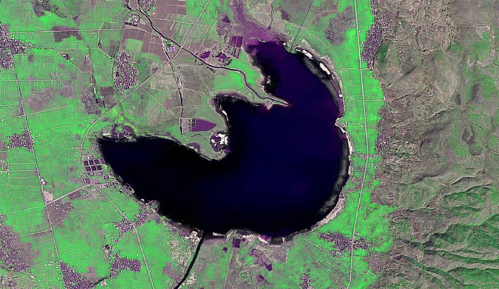
Sword Lake in Jianchuan County (Photo: Xinhua)
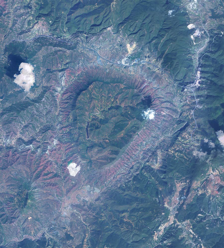
Taiji Diagram-- Yunlong Taiji
To the north of Yunlong county, the Bijiang River curves into a big “S” shape when passing here, forming a natural spectacle of Taiji symbol.
Yunlong Taiji (Photo: Xinhua)
A screw-- Luoping field
Luoping County is located at the combination point of Yunnan, Guangxi and Guizhou. It is the east gate of Yunnan. The terraced fields there are circle-shaped, looked like the lira on the screw. Most of the fields are planted with rape flowers. When spring comes, rape flowers spread all over the mountains and plains, forming a beautiful natural scenery with the terrace. And it is popular photography destination for tourists.
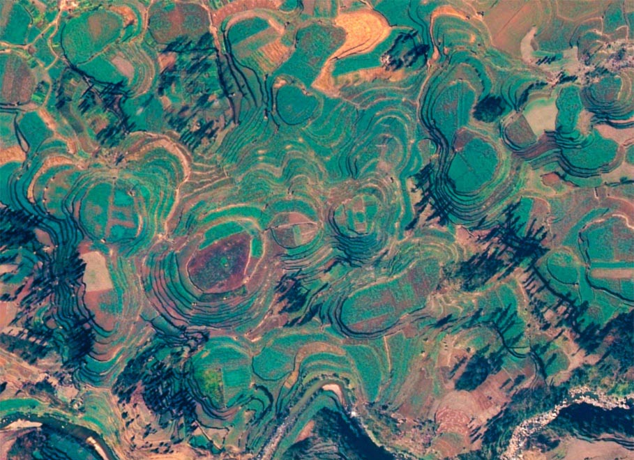
Luoping field (Photo: Xinhua)
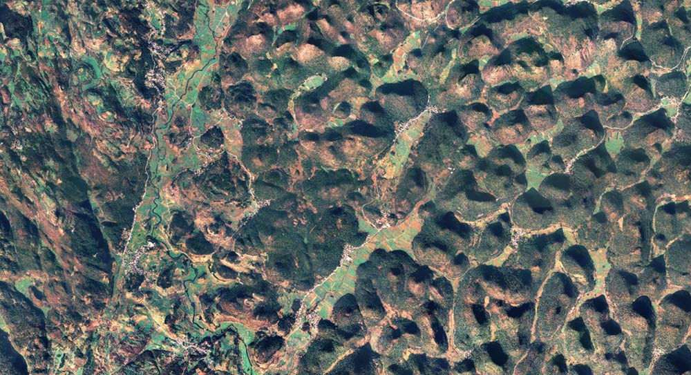
Chuanjie sinkhole
Seen from the sky, the sinkhole landform at Chuanjie district of Konglongshan Town, Lufeng County, Chuxiong Yi Autonomous Prefecture, looks particularly spectacular. According to scientific calculation, the sinkhole has a history of billions of years, with a diameter of 4,000 meters. Mountains around it are at an elevation of about 1700 meters, and the highest peak is 1865 meters. The inside area of the sinkhole is about 130,000 square kilometers. 10. Spectacular sinkhole scenery and the dinosaur ruin site leave Lufeng County a unique and mysterious geological heritage.
Chuanjie sinkhole (Photo: Xinhua)
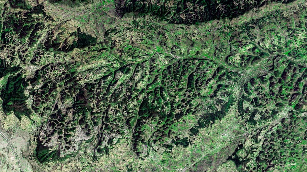
Ten- thousand Mountains in Luoping
The landscape spectacle spreads mainly in southeast Luoping, Qujing City. Consisting of patches of limestone peaks, and covering an area of hundreds of square kilometers, it is the essence of the karst landform. The height of the peaks ranges from 10 to 100 meters, with shapes of turriform, taper and round. Viewed from distance, those densely distributed peaks look really magnificent.
Ten- thousand Mountains in Luoping (Photo: Xinhua)
Wings of the Phoenix—Zhaotong
“Wings of the Phoenix” is a quote from Chinese classics The Book of Songs. It is an exact phrase to describe the mountain image captured in Zhaoting City. The mountain range diffuses from the middle to both sides, looking like the phoenix spreading its wings.
Zhaotong (Photo: Xinhua)
Another oil painting-- Liujie Town in Jinning District
Liujie Town is situated in the southeast of Jinning District , Kunming City, and is 28 kilometers away from the county. It borders on Jiangchuan district and Hongta district of Yuxi City. Viewed on the remote sensing image, the line and color of the little town look like an abstract oil painting, and it could be regarded as the world's most beautiful town.
Liujie Town in Jinning District (Photo: Xinhua)
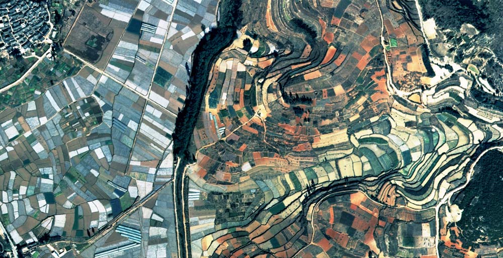
A thousand-year land sculpture -- Yuanyang terrace
The Honghe Hani terrace of Yuanyang is located in the south of Yunnan. All the terraces are built on the hillside, and the slope ranges from 15 to 75 degrees. The highest terrace there has 3000 steps, which is rarely seen both home and abroad. Yuanyang terrace is a masterpiece of landscape painting sculpted by the Hani ethnic minority for 1,300 years.
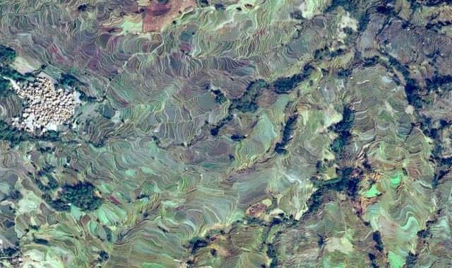
Yuanyang terrace (Photo: Xinhua)
A green maze-- Pu’er tableland tea garden
Tableland tea is widely grown in Pu’er City, the major producing place of pu’er tea. It is suitable for widespread planting for its specialty of high density and yield, high unit output, good economic returns, easy to manage and pick and meet market demand.
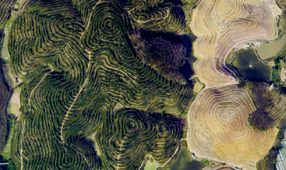
Pu’er tableland tea garden (Photo: Xinhua)
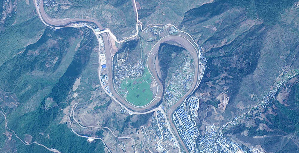
Sixty-eight Turns in Jing’anshao village, Yiliang County
The sixty-eight Turns is located in the west of Yiliang County, Kunming City. It is a winding mountain road to Jinganshao village. The road covers a 6.8km journey, with sixty-eight turns in total. It was built by the mountain ridge because of the lack of fund, and the requirement of not to occupy the land of its neighboring village.
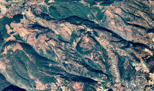
Sixty-eight Turns in Jing’anshao village, Yiliang County (Photo: Xinhua)
Violin by the water-- Nie Er Music Square
Nie Er Music Square is located in Yuxi City ,consisting of a lake, a bridge, two lines and four blocks. It was constructed to commemorate musician Nie Er. Seen from high above, the design of the square’s main body looks spectacularly beautiful, like a giant violin inlaid on the earth.
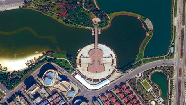
Nie Er Music Square (Photo: Xinhua)