By Tom McGregor, CCTV.com Panview commentator and editor
For the past few decades in the United States, launching satellites into orbit had become commonplace.
You could watch TV news with the anchor announcing, "NASA (National Space and Aeronautics Administration) launched another satellite into orbit today …" and the viewer could see brief video footage and the anchor goes on to the next story.
Yet, other countries - including China - have jumped into the space race to send their most state-of-the-art satellites into orbit to integrate network communications and imagery for civilian and military purposes.
China has used the Long March 4C at the Taiyuan Satellite Center to lift off a series of Gaofen satellites, which includes the Gaofen-3 that had gone into orbit in August 2016.

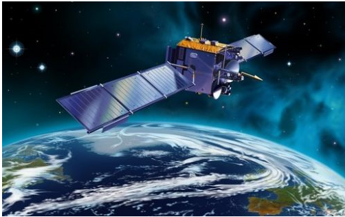
(Gaofen-3 successfully launched into orbit at the Taiyuan Satellite Center on August 10, 2016 Photo from Internet)
Hi-res imaging
The Gaofen-3, China's high-resolution SAR (Synthetic Aperture Radar) has passed all imagery tests while in orbit and runs fully-operational.
Officials at the State Administration of Science, Technology and Industry for National Defense (SASTIND) held a press conference in January 2017 to unveil new photos from satellite imagery.
The Gaofen-3 can take near real-time images of landmass and bodies of water from 740-km. above the Earth's surface. Even on cloudy or rainy days or evenings, the satellite gets a clear view with resolution accuracy from 1 meter in distance.
Tong Xudong, senior engineer of SASTIND, disclosed the satellite offers an all-weather, 24-hour observation service. Gaofen-3 orbits in a polar rotation to capture close-up imagery of China and surrounding region on a frequent basis.
It's China's first low orbit remote sensing satellite with a long lifespan and 12-imaging modes with spatial resolution ranges: 1m.-500m. and the largest viewing swath - 650km.
Set for disaster prevention
The Gaofen-3 was specially-designed to aid China's natural disaster rescue workers. A huge earthquake rumbles or typhoon sweeps into China’s coastlines, the satellite can pin-point the extent of damage on infrastructure.

The satellite can detect early warning signs of natural disasters, for example, a typhoon moving towards China that is gaining strength or a blowing blizzard in northeast China that has left drivers trapped on icy roads.
The near real-time imagery can be transmitted to Chinese civilian government agencies, including: State Oceanic Administration, Ministry of Civil Affairs, Ministry of Water Resources and China Meteorological Administration, etc.
Gaofen-3 plays a crucial role as part of China's high-resolution Earth Observation System (CHEOS), which scans the satellite's ground track while measuring microwave beams that are reflected off the planet's land and water surfaces to depict maps of structures, ships and urban infrastructure, according to Spaceflight Now.
Hi-quality resolution
The China Academy of Space Technologies (CAST) assigned its scientists to develop Gaofen-3 as the first civilian satellite with radar imaging. Leading the project has been Wu Yanhua, deputy head of SASTIND.
"The satellite will provide high-quality, reliable and quantitative images for ocean monitoring, water conservancy monitoring and disaster monitoring, which will give strong technological support to building our maritime strength and the Belt and Road Initiative (B&R)," Spaceflight Now quotes Wu as saying.
Gaofen-3 can aid rescue workers, as well as those employed to construct major infrastructure projects along the B&R sphere that includes member states from Asia, Europe, Africa and the Middle East.
Gaofen-3's chief designer, Liu Jie, believes the satellite is "the best of its kind in the world in terms of technological level and imaging mode."
The CHEOS system is doing its part to integrate observations from space, air and ground.
Developing CHEOS
The CHEOS arrangement, as reported by NASA Spaceflight.com, has been set up by SASTIND to develop a "space-based system, near space system, aerial system, ground system and applications system as a whole to materialize the Earth's observation," that coincides with "high temporal, spacial and spectral resolution."
SASTIND says progress has gone "smooth."
The launch pad of the Gaofen, translated in Chinese - high resolution, was at the Taiyuan Satellite Launch Center (TSLC).
TSLC is the on-site location for Lvliang Command Post headquarters with four subordinate tracking stations at: Yangqu (Shanxi Province), Lishu (Shanxi Province), Yulin (Shaanxi Province) and Hancheng (Sahaanxi Province).
The launch center has two single-pad launch complexes, technical area for rockets and spacecraft, communications center, mission command and control center, and space-tracking center.
Americans could comprehend the significance of the TSLC if they understand the site serves in similar roles as NASA’s Cape Canaveral, Fl. launch pad and Houston’s NASA space command center.
Focusing on images
As China develops more powerful and innovative satellites, the country's citizens will receive better access to hi-res images that can save lives, warn of impending dangers and aid construction workers.
Gaofen-3 is the most-advanced hi-res satellite used for civilian purposes. Chinese scientists have even eclipsed American scientists in the field.
SASTIND has plans to introduce Gaofen-5 hyperspectrual satellite, scheduled for launch in September 2017, which would be a major upgrade from Gaofen-3.
Satellites are serving a greater capacity for civilian usage, while the near real-time imagery transmitted to Chinese government agencies can provide a better understanding of what’s really happening in our world today, which can lead to a more solution-based society.
( The opinions expressed here do not necessarily reflect the opinions of Panview or CCTV.com. )

Panview offers a new window of understanding the world as well as China through the views, opinions, and analysis of experts. We also welcome outside submissions, so feel free to send in your own editorials to "globalopinion@vip.cntv.cn" for consideration.


