


Mexico's southern Yuca'tan Peninsula has several thousand "ce'notes". The word means a flooded cave. And given the huge archaeological significance, the country's National Institute of Anthropology and History is sponsoring a massive long-term project to map them.
With a computer program that processes thousands of photographic images captured from different angles, the project is creating 3D models of the caves.
The area to be explored covers 145,000 square kilometres over the southern Mexican states of Campeche, Yucatan, and Quintana Roo.
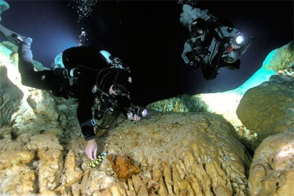
Archaeologists explores underwater caves in Yucatan.
"(Underwater archaeologists) no longer need to carry our ruler or tape-measure to measure a skull or the distance between two elements or to measure a small lesion. Photography, the 3D model, gives us all that information and more," said Guillermo De Anda Alanis, underwater archaeologist
A man's skull, along with a piece of pottery found in a cenote, are printed out in 3D. This technology is immensely useful for the archaeologist's mission.
"Additionally, we can manipulate it (image) digitally however we want. We can share (our discoveries) with an unlimited number of colleagues or students. And another big advantage is that we are able to reproduce it physically (findings)," he said.
Much of the work will focus on the area of Tulum, with its skeletons of early men and a large number of extinct fauna of the Pleistocene period.